About Samtredia
ExploreSamtredia — History and City Development (Detailed Overview)
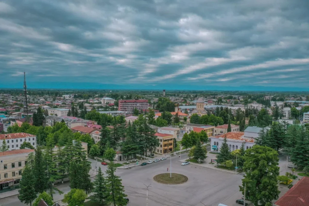
Samtredia is a city in Georgia’s Imereti region and the administrative center of Samtredia Municipality. It lies on the Kolkhian Lowland, in the wide western Georgian plains shaped by rivers and natural transit corridors. From the very beginning, Samtredia’s identity has been tied to movement and connections: it is widely known as a major railway and road junction, and that role has directly influenced its economy, growth, and urban character.
Samtredia’s story is best understood through this lens. It is not an ancient fortress-city that grew around medieval walls; instead, its urban form was largely shaped by modern infrastructure, above all by the railway era, which turned a rural settlement into a strategically placed town and, later, a city.
Early Mentions: The Village of Samtredia
Before becoming a city, Samtredia existed as a village-type settlement. Regional reference sources note the place from the second half of the 18th century as the village of Samtredia.
The Kolkhian Lowland historically featured wetlands, river networks, and seasonally saturated terrain, which often slowed dense urban development. That is why Samtredia did not form as a “classical” old urban center early on. Its more visible urban history begins with the infrastructure transformation of the late 19th century.
The Railway Era: A “New Beginning” and the Rise of a Township
The turning point in Samtredia’s development was the launch of the Poti–Tbilisi railway. Regional sources emphasize that from 1872, after the Poti–Tbilisi line began operating, Samtredia was already described as a township (daba).
Railways do more than connect places—they create new urban economies:
stations require labor, services, and storage;
movement drives trade and small business;
neighborhoods expand around the station and related facilities.
In lowland western Georgia, this process went hand in hand with broader land improvement: regional accounts note that infrastructure growth was associated with drainage of wetlands and more intensive land use, which further supported settlement growth.
Why Samtredia Fit the Network: The Logic of a Western Georgian Junction
In the broader timeline of Georgian rail development, operations in the western section began in 1871, and the first passenger train from Poti to Tbilisi ran on 10 October 1872. The emergence and strengthening of this “backbone” created strong growth conditions for settlements that could function as junctions. Samtredia’s importance expanded precisely because it sat where routes and flows naturally converged and could be redistributed.
1921: City Status and Urban Consolidation
Samtredia received city status in 1921. This was not merely a formal label. City status typically brings stronger administrative functions and urban consolidation:
expanded municipal services and institutions;
more structured planning and public infrastructure;
a clearer role as a regional center.
Roads in the Modern Era: S1, S12, and Today’s Transport Role
Samtredia’s junction function remains clear today. Georgian sources describe the city directly as a railway and road hub, noting that the S1 highway passes south of the city, while the S12 highway begins from Samtredia.
This keeps Samtredia relevant as a practical “transfer point” across western Georgia—especially for routes involving Kutaisi, Guria, Samegrelo, and the Black Sea corridor. Another factor strengthening its location is that Kutaisi International Airport is located roughly 10 km away.
Urban Life and Economy: A City Built Around Movement
Historically, Samtredia’s growth fits the pattern of “transport cities”:
railway infrastructure creates stable employment ecosystems;
proximity to major routes supports services and small businesses;
the city becomes a natural regional hub for travel, logistics, and everyday mobility.
The rhythm of such cities is often shaped by schedules and flows—station activity, seasonal traffic, and constant movement. Samtredia developed as a place that serves travel and transit, while also functioning as a municipal and residential center in its own right.
FAQ (EN)
Q: When did Samtredia’s main urban growth phase begin?
A: With the operation of the Poti–Tbilisi railway, after which Samtredia is described as a township from 1872.
Q: When did Samtredia become a city officially?
A: In 1921.
Q: Why is Samtredia considered a transport hub?
A: It is a rail and road junction: the S1 highway runs south of the city, and the S12 highway starts from Samtredia.
Q: Is there any link between development and wetlands in the area?
A: Regional sources note that development was associated with drainage of wetlands and land improvement, supporting settlement expansion.
Sources
Encyclopedic & General Overview
Wikipedia — Samtredia
https://en.wikipedia.org/wiki/SamtrediaGeorgian Wikipedia — სამტრედია
https://ka.wikipedia.org/wiki/სამტრედია
Early Mentions / Village Background (2nd half of the 18th century)
Georgian Travel Guide — Samtredia (early mentions)
https://georgiantravelguide.com/ka/samtrediaSamtredia Municipality (Official) — Samtredia Today (early mentions)
https://samtredia.gov.ge/en/municipality/samtrediatoday.html
Railway Era (1871–1872) / The Main Growth Driver
Samtredia Municipality (Official) — railway built 1871–1872; junction narrative
https://samtredia.gov.ge/en/municipality/samtrediatoday.htmlGeorgian Travel Guide — Poti–Tbilisi railway era; township context
https://georgiantravelguide.com/ka/samtrediaWikipedia — Georgian Railway (1871–1872 timeline context)
https://en.wikipedia.org/wiki/Georgian_Railway
City Status / Administrative Development (1921)
Wikipedia — Samtredia (city status / established)
https://en.wikipedia.org/wiki/SamtrediaGeorgian Wikipedia — სამტრედია (city status)
https://ka.wikipedia.org/wiki/სამტრედია
Transport Hub Today (roads/rail)
Georgian Wikipedia — Samtredia (S1/S12; hub description)
https://ka.wikipedia.org/wiki/სამტრედია