



Uplistsikhe
Link copied
Photograph: EvgenyGenkin (CC BY-SA 3.0), Supanut Arunoprayote (CC BY 4.0), Marcin Konsek (CC BY-SA 4.0)
A town cut into the rock on the left bank of the Mtkvari, 10 kilometres east of Gori.
About
Uplistsikhe is cut into a rock massif on the left bank of the Mtkvari, 10 kilometres east of Gori. The inner city covers about 4 hectares.
Among the structures of the complex are a large rock-cut hall with a semicircular vault and octagonal coffers, a three-nave brick basilica, a large tunnel running down towards the Mtkvari, and a small rock gate. The great rock gate begins 700 to 800 metres north of the inner city and runs for about 150 metres.
The name is linked to the word for lord: tradition connects the place with a leader who stood at the head of a tribal union.
- Period
- First half of the 1st millennium BC
History
Cutting of the complex began in the first half of the first millennium BC, and a late Bronze Age settlement is attested in the area as well.
In the sixth to the fourth centuries BC there was an urban settlement here, and in the Hellenistic period, from the end of the fourth century to the third century BC, it became a large urban centre.
From the fourth century AD Uplistsikhe lost its old importance. In the ninth and tenth centuries it was fought over, and after the unification of the country in the 970s it gradually lost its weight; the process was completed when David the Builder freed Tbilisi in 1122.
Its military and strategic role ended with the Mongol invasions of the thirteenth century; afterwards the people nearby used it only as a temporary refuge.
By presidential decree No. 665 of 7 November 2006 Uplistsikhe was given the category of an immovable monument of national significance. On 24 October 2007 it was entered on the tentative list of UNESCO World Heritage.
Visit info
Uplistsikhe is an open-air site run as a museum reserve. Opening hours and admission are best checked locally before the visit.
From the car park and the entrance gate the way up follows narrow paths and flights of steps, only some of them with railings, so firm shoes are needed.
Safety
Paths and steps on the site are narrow and only some have railings; hold on to children. Take extra care on the rock after rain.
Tip
The site lies in the open on a rock massif, so in summer a morning or evening visit is more comfortable; carry water and something for your head. Go down the tunnel towards the river carefully.
Sources
Nearby places
All places in the region
Places of the same kind
Ruins — all places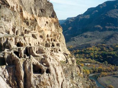
Nearby settlements