



Gori Fortress
Link copied
Photograph: Tiia Monto (CC BY-SA 4.0), Andrzej Wójtowicz (CC BY-SA 2.0), I kynitsky (CC BY-SA 4.0), Teramo Castelli (Public domain)
A medieval citadel on a high rocky hill in the centre of Gori, where the Great Liakhvi meets the Mtkvari. The site was already fortified in the last centuries of the first millennium BC, and written records name it as Gori Fortress from the thirteenth century. Whoever held it held all of Shida Kartli. The fortress took its present form under King Rostom in the 1630s and Erekle II in 1774, and it is an immovable cultural monument of national significance.
About
Gori Fortress stands on a high rocky hill in the centre of the town and looks down on it. Its outline follows the natural relief of the hill, so its shape is irregular: the inner fortifications take up the whole plateau, and on the western slope the walls run down towards the road. Originally the walls reached the river below and water was brought up through a tunnel, but the river has since moved away. The hill stands where the Great Liakhvi meets the Mtkvari: the road from Europe to Asia ran along the Mtkvari and the road from the north into Transcaucasia along the Liakhvi, and the fortress controlled both.
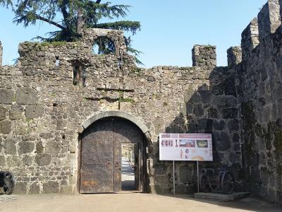
The fortress is built of river cobblestone; dressed stone is used in the early layers, and brick in places. The wall of the oval citadel is up to 10 metres high. Its best preserved part, Tskhrakara ("the Nine-gated"), adjoins the citadel on the west, and supplementary walls run on the south and east. The original entrance cannot be seen; a later arched gate stands in the middle of the south wall. The fortress had a tunnel for drawing water and a reservoir, and in the middle of the citadel there is a huge well from which secret passages are thought to have led.
In the south-eastern part lie the ruins of a small church, and in the eastern part stands a hall church of the eleventh–twelfth centuries. A British encyclopaedia of 1845 described the castle as oblong, about 200 paces long and already abandoned, with a chapel in its south-eastern corner the only part still in use. Gori Fortress has the status of an immovable cultural monument of national significance.
- Construction period
- The site was fortified from the last centuries of the first millennium BC; the fortress took its present form in the 1630s (King Rostom) and in 1774 (Erekle II)
- Material
- River cobblestone; dressed stone in the early layers, brick in places
- Restoration notes
- Badly damaged by the earthquake of 1920; partly restored in the 1950s, with periodic repairs since
History
Ruins on the northern slope and archaeological evidence show that a strong fortification stood here in the last centuries of the first millennium BC, with a population living around it. Written records first name it as Gori Fortress in the thirteenth century. The fortress was of great strategic importance and held a large garrison; for centuries the kings of Kartli and Kakheti, the Mongols, the Persians and the Ottomans fought over it. In the sixteenth century the Ottomans took it to bring Tbilisi to heel. In 1598 the Georgians, led by King Simon I, besieged it for nine months without success; in 1599 they pretended to lift the siege for Lent and then took back the citadel in a surprise night attack. In the seventeenth century the fortress kept changing hands between the Georgians and the Persians.
Over the centuries the fortress was destroyed and renewed many times. King Rostom restored its main part in the 1630s and garrisoned it with Iranian soldiers. Rostom asked the Italian missionary Cristoforo Castelli, who lived in Gori, to draw the fortress; his drawing of about 1642 is an important historical picture of it. The fortress took its present form in 1774, when King Erekle II had it thoroughly repaired.
In the first years after Kartli-Kakheti was joined to Russia (1801), the fortress still played a strategic role and a grenadier battalion of the Russian army was stationed here, but its importance then gradually declined and the fortifications fell out of use. The town plan of 1824 shows the citadel, the town on the slopes of the hill and a moat running round both. The earthquake of February 1920 badly damaged the fortress. It was partly restored in the 1950s, and repairs have been carried out from time to time since.
Visit info
The fortress is in the centre of Gori, about 85 kilometres by road from Tbilisi. The Joseph Stalin Museum is about 500 metres from the fortress in a straight line, and Ateni Sioni is about 12 kilometres by road from Gori. Check the opening hours and entry conditions on site.
Safety
The fortress stands on a rocky hill: keep away from the edges of the walls and the steep slopes, and hold children by the hand. Stone steps and paths are slippery after rain, so wear shoes with a good grip.
Tip
On the west side look for Tskhrakara, the best preserved part of the fortress, and on the south wall for the later arched gate. The fortress combines well in one day with the Stalin Museum, where one of the canvases, by the painter Alvaridze, shows the young Soso Jughashvili with his comrades on Gori Fortress itself, and with Ateni Sioni, south of Gori in the Ateni valley.
Sources
Nearby places
All places in the region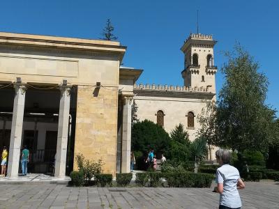
Places of the same kind
Fortress — all places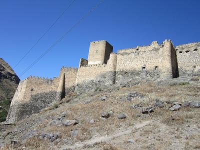
Nearby settlements