



Machakhela National Park
Link copied
Photograph: Alexey Komarov (CC BY-SA 4.0), Lasha (CC BY-SA 4.0)
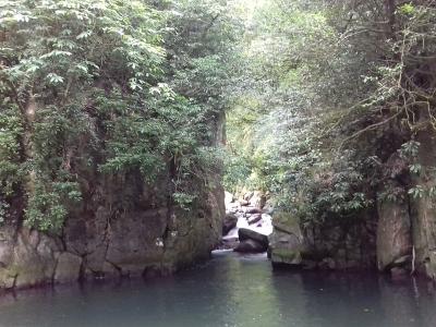
A national park founded in 2012 in the valley of the Machakhelistskali, in Khelvachauri municipality on the Georgian-Turkish border, 30 kilometres from Batumi: slopes clothed in Colchian forest, the Twin Waterfall, Mount Mtavarangelozi with views over Batumi and the Chorokhi valley, the twelfth-century arched Tamar bridge, the Chkhutuneti fortress and the Machakheli ethnographic museum in a 200-year-old mosque.
About
Machakhela National Park lies in Adjara, in Khelvachauri municipality, in the valley of the Machakhelistskali, 30 kilometres from Batumi. It was created on the Georgian-Turkish border for the long-term protection of the ecosystem of Colchian forests and the preservation of unique biological and landscape diversity. Its area is given as 7,333.18 or 8,733 hectares. The administrative and visitor centres are in the centre of the village of Acharisaghmarti.
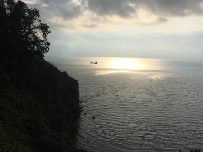
95% of the park is covered with forest and impenetrable scrub: chestnut, beech, hornbeam and alder forests clothe the slopes of the river, and relict and rare species grow here too, Colchian box, Colchian hazel, Georgian walnut, Ungern's rhododendron, yew and elm. In the valley are the ruins of the fortresses of historic Machakheli, arched bridges and winepresses, and from the slopes of Mount Mtavarangelozi Batumi and the Machakhela gorge come into view.
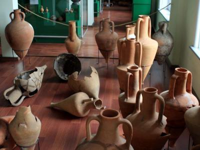
Around the park, in the village of Acharisaghmarti, about 400 metres from the visitor centre, stands a Second World War cannon; in the village of Tskhemlara the arched Tamar bridge built in the twelfth century; and about 4 kilometres from the visitor centre the Chkhutuneti fortress and wine cellars of the eleventh–thirteenth centuries. In the village of Zeda Chkhutuneti, in a mosque built 200 years ago, is the Machakheli historical and ethnographic museum, where more than eight hundred exhibits tell the social, cultural and religious history of the valley.
- Main routes
- Twin Waterfall Trail (10 km, easy); Mount Mtavarangelozi Trail (9 km, moderate); Kokoleti Trail (15 km, moderate, border zone, permit needed)
- Access notes
- The administrative and visitor centres are in the centre of the village of Acharisaghmarti in Khelvachauri municipality, 30 km from Batumi
History
Machakhela National Park was founded in 2012 to preserve unique biological and landscape diversity, to protect the ecosystem of Colchian forests in the long term, to ensure ecological safety and to develop tourism and recreation in a natural setting. The valley is part of historic Machakheli, whose upper part lies today in Turkey: from the viewpoint of the Kokoleti trail one sees the Camili Biosphere Reserve in Turkey and the six villages of historic Upper Machakhela.
By one account the name Machakheli is tied to the layout of these villages: in the branching valley of the river they form the shape of a wrist and a hand, whence "Majakheli", that is, Machakheli. The history of the valley is kept by its medieval fortresses, arched bridges and wine cellars, and by the 200-year-old mosque of Zeda Chkhutuneti.
Visit info
The visitor centre is in the village of Acharisaghmarti; the drive from Batumi to the park is about 26.6 kilometres and takes 45 minutes. From the area by the Batumi market (Parekhi), bus No. 71 to Acharisaghmarti leaves at 12:00, No. 75 to Zeda Chkhutuneti at 12:30 and No. 72 to Chikuneti at 14:00 (also at 08:00, on school days only). The active tourist season runs from May to October, and the centre is open 09:00–18:00 on weekdays. A tent pitch costs 10 lari per person per day, and tents, sleeping bags and binoculars can be hired. There are three hiking trails combined with a road: to the Twin Waterfall (10.3 km of road to Zeda Kokoleti, then a 300-metre path to the 47-metre waterfall), to Mount Mtavarangelozi (5 km of road from the village of Sindieti, then 4.1 km on foot; a 6.6 km road also runs from the visitor centre to the mountain), and the Kokoleti trail (9 km by road, 6 km on foot), for which a permit must be arranged with the administration 5 working days in advance, as it lies in the border zone.
Safety
The Kokoleti trail lies in the border zone, so do not walk it without a permit and do not leave the marked path towards the border. The slopes are covered with forest and impenetrable scrub, so stay on the trail. By the waterfall the stones are wet and slippery.
Tip
From the summit of Mount Mtavarangelozi the views open over Batumi, Machakhela National Park and the Chorokhi valley, and tents may be pitched near the mountain by a spring. On the way to the Twin Waterfall see the Chkhutuneti fortress and the arched Tamar bridge as well. The museum at Zeda Chkhutuneti is the best start for understanding the history of the valley.
Sources
Nearby places
All places in the region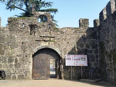
Places of the same kind
National Park — all places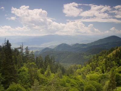
Nearby settlements