



Mtirala National Park
Link copied
Photograph: Kober (CC BY-SA 4.0), Krzysztof Ziarnek (CC BY-SA 4.0), Paata Vardanashvili (CC BY-SA 4.0)
A national park between the Black Sea and the mountains of Adjara, in Kobuleti, Khelvachauri and Keda municipalities, of about 15,698 hectares: one of the wettest places in Georgia, with 4,520 millimetres of rain a year, which gave Mount Mtirala, "the weeping one", its name. Colchian forest, brown bears, an autumn migration of more than a million raptors, and since 2021 part of the UNESCO World Heritage site of the Colchic Rainforests and Wetlands.
About
Mtirala National Park spreads over the Kobuleti–Chakvi range in the Autonomous Republic of Adjara, between the municipalities of Kobuleti, Khelvachauri and Keda; it covers about 15,698 hectares and adjoins the Kintrishi Protected Areas. The park is 25 kilometres from Batumi and 27 from Kobuleti, and the administration is in the township of Chakvi. Mount Mtirala stands between the Black Sea and the mountains of Adjara on the watershed of the Chakvistskali and the Qorolistskali; it is built of Middle Eocene volcanic and sedimentary rocks and holds back the moist air from the sea, so that 4,520 millimetres of rain fall here a year, making it one of the wettest places in the country. That is the origin of the name: Mtirala means "weeping".
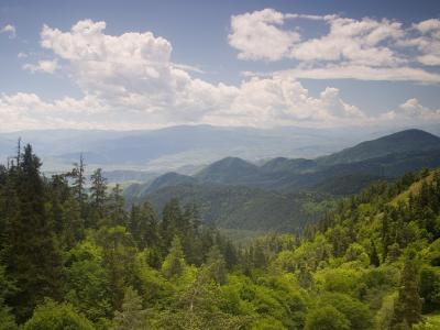
The park is covered with Colchian forest, stands of chestnut and beech and mixed forest of Colchian type with an understorey of rhododendron, cherry laurel, Colchian holly, Colchian box and lianas; Adjara-Lazeti endemics and species of the Red List also grow here. The fauna includes brown bear, lynx, wolf, roe deer, wild boar, the Caucasian salamander and the Caucasian viper. The park lies in the Batumi bottleneck, one of the main corridors of raptor migration, where in autumn more than a million raptors of 35 species pass through, among them more than half the world populations of the booted eagle and the European honey buzzard.
For visitors the park has marked one- and two-day trails, picnic and camping sites, fire pits, a 220-metre zipline and a rope park with family and adult zones; the bird-watching tower is in the village of Qorolistavi. Since 2021 the park has been part of the UNESCO World Heritage site of the Colchic Rainforests and Wetlands.
- Main routes
- Chestnut Forest Trail (1 day, 7 km, easy); Tsivtskaro Trail (2 days, 16 km, moderate, with a shelter)
- Access notes
- The administration is in the township of Chakvi, 13 Megeneishvili Street; from there 15 km of narrow asphalt road lead to the visitor centre in the village of Chakvistavi
History
Mtirala National Park was formerly known as the Tsiskara Reserve. Its purpose is to protect the relict forest of Colchian type and the biodiversity that have survived here thanks to heavy rainfall and varied relief. The park adjoins the Kintrishi Protected Areas.
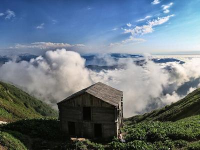
The park has ecotourism infrastructure: the visitor centre at Chakvistavi, marked trails, a tourist shelter and cottages, the zipline and the rope park. In 2021 Mtirala, together with other Colchian forests and wetlands, was inscribed on the UNESCO World Heritage List as the Colchic Rainforests and Wetlands, for the outstanding value of its relict forests, wetland ecosystems and biodiversity.
Visit info
Batumi to Chakvi is 10 kilometres (15 minutes by car), and from Chakvi it is 15 kilometres by a narrow asphalt road to the visitor centre at Chakvistavi (45 minutes). Marshrutka No. 40 runs from Batumi to Chakvi every 6 minutes from the area by the Batumi shopping centre (Aghmashenebeli Street), and bus No. 13 every 30 minutes. The administration is in the township of Chakvi at 13 Megeneishvili Street, and the park entrance is 2 kilometres from the village of Khala. Opening hours are 09:00–18:00 all year. A night in the cottages costs 30 lari per person (10 lari for schoolchildren and students), a tent pitch 10 lari and the zipline 20 lari. Trails: the Chestnut Forest Trail (1 day, 7 km, at 265–442 metres, easy) follows the Chakvistskali valley from the visitor centre to a waterfall more than 28 metres high, 3 kilometres on, and a lake; the Tsivtskaro Trail (2 days, 16 km, at 260–1,250 metres, moderate) climbs through Colchian forest to the beech woods, with an 8-person shelter at kilometre 9.
Safety
Mtirala is one of the wettest places in Georgia, so rain can come at any time and the paths are wet and slippery; a raincoat and shoes with grip are essential. Keep to the marked trails. On the zipline visitors are fitted with harnesses and helmets and served by guides. Brown bears live in the forest, so keep food sealed.
Tip
For a short visit the Chestnut Forest Trail is best, since the waterfall, the lake and the zipline fit into one day; there is a camping site by the waterfall, and trout are plentiful in the river pool. To see the bird migration, go up the Qorolistavi watchtower in autumn. For the two-day Tsivtskaro Trail, book the shelter or a cottage in advance with the park's visitor services specialist.
Sources
Nearby places
All places in the region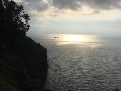
Places of the same kind
National Park — all places
Nearby settlements