



Ushba and the Shdugra Waterfall Trail
Link copied
Photograph: Alexey Komarov (CC BY-SA 4.0), madras91 (CC BY 2.0), FingerWiki (CC BY-SA 4.0), Peyman Zehtab Fard (CC BY 2.0), Philips Christiaan Visser (CC0)
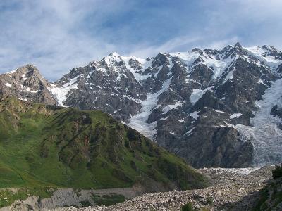
The "Matterhorn of the Caucasus": the twin-peaked Ushba, 4,710 and 4,690 metres, the home of Dali, held by many climbers to be the hardest summit of the Caucasus, first climbed on the north summit in 1888 and the south in 1903, and the path from Mazeri up the Dolra valley to the Shdugra waterfall and the Ushba glacier beneath its walls.
About
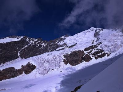
Ushba is a twin-peaked mountain in Mestia Municipality on the Svaneti Caucasus, on a short spur of the main watershed ridge south-east of Elbrus and only 1.5 kilometres from the Russian border; Mestia lies 10 kilometres to its south-east. The south summit is 4,710 metres and the north 4,690, and though it does not rank among the ten highest peaks of the Caucasus, its spire-shaped double summit has earned it the name "Matterhorn of the Caucasus", and many climbers hold it the hardest ascent in the range: the straight-line distance between the summits is 636.9 metres, while the "Ushba traverse" runs to 1,500–2,000 metres because of the terrain. In Georgian mythology Ushba is the home of Dali, the goddess of the hunt; the name reads in Svan as "mountain of misfortune" (ush, misfortune, ba, mountain), and in Karachay-Balkar as "three heads". The peak is built of Palaeozoic granites and crystalline schists under a nival landscape, and the Gul and Ushba glaciers descend its slopes. The standard route to the north summit is the north-east ridge from the Russian side, while the routes on the south summit from the Georgian side include two graded ED, extremely difficult; in all 19 routes have been climbed on the south summit (7 of them grade 6A) and 13 on the north. A climbers' club called Ushba exists in London.
The most popular path to the foot of Ushba starts from the village of Mazeri in the Becho community and follows the Dolra valley through forest over wooden footbridges: to the Shdugra waterfall it is 6.5 kilometres and about two and a half hours, with 458 metres of ascent, and then a hard stretch of 2.4 kilometres with 494 metres of ascent leads to the Ushba glacier, with both summits overhead. From Mazeri to the glacier and back is about 18 kilometres with about 950 metres of ascent, some four and a half hours each way; to the waterfall and back only, 13 kilometres. The way back is the same as the way in.
- Difficulty
- Easy
- Route type
- Out & back
- Surface
- Mixed
- Access notes
- The path starts from Mazeri up the Dolra valley; 6.5 kilometres to the waterfall, then a further 2.4 kilometres and 494 metres of ascent to the Ushba glacier, a hard stretch
- Safety notes
- Before the waterfall, beyond the wooden bridge over the Dolra, is a border patrol, so carry your passport; on the way to the glacier cross the river with caution and stay clear of the ice
History
The first attempts on Ushba were made in 1868 by English climbers led by Douglas Freshfield, without success; in 1888 John Garforth Cockin and Ulrich Almer reached the north summit at the fourth attempt by way of the Gul glacier, the first successful ascent. The south summit fell at the sixteenth attempt, in 1903, to the German-Swiss-Austrian expedition of Willi Rickmer Rickmers, whose summit party was led by Adolf Schulze (with R. Helbling, A. Weber and F. Reichert); over the following 60 years only four attempts on the south summit succeeded. In 1934 the first Georgian party climbed Ushba, the siblings Alexandra and Aliosha Japaridze, Gio Nigurian and Iagor Kazalikashvili, and Alexandra Japaridze became the first woman on the summit; in 1937 Gabriel, Beknu and Besarion Khergiani, Chichiko Chartolani and Maksime Gvarliani made the first ascent of the south summit by its hardest southern wall, which laid the foundation of rock climbing on Ushba. In the Soviet Union Ushba, with Chatyn-Tau and Free Korea Peak, counted among the most difficult and prestigious summits.
The mountain remains dangerous: in the storms of August 2012 one climber died and another, Andranik Miribyan, was trapped for four days on a ledge near the summit and descended by himself without an ice axe; in September 2013 two Russian tourists went missing; in May 2025 the Georgian mountain guide Nikoloz Faliani died in a fall, and three members of his party were evacuated by helicopter from 3,600 metres.
Visit info
The path starts from the village of Mazeri, about 24 kilometres by road from Mestia towards the Becho valley, some three quarters of an hour by car. It first runs north through meadows with the Dolra on the right, passes the Hikers Inn and the Dau restaurant, then enters the forest and crosses the Dolra by a wooden bridge; just beyond the bridge is a border patrol, which may ask for your passport. The turn-off for the waterfall is marked by a yellow sign and a red and white arrow.
Safety
On the way to the glacier the river below the waterfall is powerful and can be crossed only with caution; take care on the rocks and stay clear of the glacier itself. About 470 metres above the waterfall the path turns sharply to the right at a turn that is hard to see; if you find yourself climbing rocks, you have missed it. Climbing the summit is a mountaineering expedition of the highest grade.
Tip
The path to the Shdugra waterfall is relatively easy and rich in views; the stretch from the waterfall to the glacier is short but very steep and suits the fit. On the moraine, on the way to the glacier, stands a memorial to the climbers who died on Ushba.
Sources
Nearby places
All places in the region
Places of the same kind
Trail — all places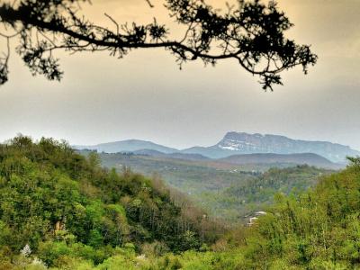
Nearby settlements