



Lajanuri Reservoir
Surmushi Tsageri Municipality Racha-Lechkhumi and Kvemo Svaneti
Link copied
Photograph: G. N. (CC BY-SA 3.0), Giorgi Abdaladze (CC BY-SA 4.0)
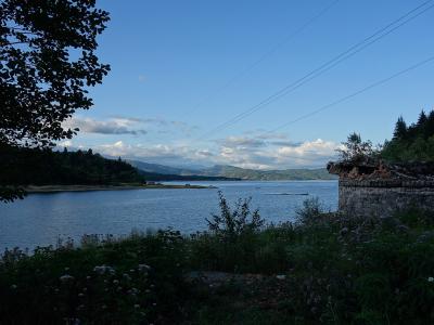
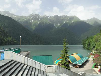
An oval lake in the valley of Lechkhumi at Surmushi, held back since 1953–1960 by a 69-metre arch dam, the first tall dam of Georgia: 3.2 kilometres long and up to 70 metres deep, fed by the Lajanura and by water brought through a tunnel from the Tskhenistskali, it drives the underground Lajanuri power plant and shows as a turquoise ribbon from the viewpoint of Orbeli.
About
The Lajanuri reservoir lies in Tsageri municipality, in the narrow valley of the lower Lajanura by the village of Surmushi. It is held by a tall arch dam, a concrete arch 69 metres high with a crest 127 metres long, built in 1953–1960 and for a long time the first and only tall dam of Georgia. The lake is oval: 3.2 kilometres long, 1 kilometre at its widest and half a kilometre on average, 1.6 square kilometres in area, 70 metres deep at most and 30 on average, holding 50 million cubic metres of water. It is fed by the Lajanura and its small tributaries, the Kheleshurisghele, the Liamghvrie and the Usakheloghele, and by water brought from the river Tskhenistskali by canal and tunnel. The reservoir regulates the flow by the day and feeds the underground Lajanuri power plant, whose capacity is 112.5 megawatts and whose annual output is 505 million kilowatt-hours.
The lower part of the basin is built of thick-bedded Cretaceous limestone and the upper of sandstone, marly shale and conglomerate, so the slopes are prone to landslides; wave action on the shores is slight, but the tributaries bring solid load, and the sediment settled on the bottom by the dam is more than 40 metres thick. Seen from above, from the viewpoint of the village of Orbeli, the lake shows as a turquoise ribbon laid in the green valley of Lechkhumi, one of the most photographed views of the province.
The Lajanuri plant, whose design is tied to the name of the engineer B. Chichinadze, was one of the first successful experiences of tall-dam building in the Soviet Union and opened the way for the dams raised in the republics in the decades that followed. The reservoir stands on the route to Lailashi, Tsageri and Khvamli, halfway along the wine valleys of Lechkhumi, the Tskhenistskali and the Rioni.
- Access notes
- The Kutaisi–Tsageri road enters the Lajanuri valley from Alpana and follows the shore of the reservoir; the lake is seen from above from the village of Orbeli
- Ticket required
- No
- Parking available
- Yes
- Safety notes
- The shores are steep and prone to landslides, the bottom drops to 70 metres and swimming is dangerous; the dam and the plant are guarded sites
History
The narrow valley of the Lajanura was chosen by Soviet hydropower engineering in the 1950s, when it was decided to build the first tall dam in Georgia: construction began in 1953 and finished in 1960, a 69-metre concrete arch was set into the rocky gorge, the valley filled with water and extra water was brought by tunnel from the Tskhenistskali. The underground station, whose design is tied to the name of the engineer B. Chichinadze, was with its 112.5 megawatts one of the largest power plants of Georgia at the time.
The successful building and running of the Lajanuri plant showed the Soviet Union that tall arch dams could be raised in the seismic valleys of the Caucasus, and it opened the way for other tall dams in the decades that followed. The reservoir works to this day, while its bottom slowly fills with sediment. Since the 2000s Lajanuri has been part of the tourist routes of Lechkhumi, and the Orbeli viewpoint is a favourite stop of photographers.
Visit info
The reservoir lies on the road from Kutaisi to Tsageri, about 10 kilometres from Alpana and 18 from Tsageri; it is an hour and a half by car from Kutaisi, and the Tsageri marshrutka leaves the Kutaisi bus station at 11:00, 14:00 and 16:00 and passes through the valley. The road follows the shore of the lake and there are pull-offs in several places; the best view is from the village of Orbeli, above the road. The lake is open and free, with no ticket or permit; the dam and the power plant are guarded sites and cannot be entered. There is no swimming or boating, and food is found in Tsageri and Alpana. The season is May to October.
Safety
The lake is up to 70 metres deep, the shores are steep and prone to landslides, the water is cold and the level changes fast when the plant is running, so swimming is dangerous. Walking on the dam and entering the plant grounds are forbidden. On the valley road, especially in spring and after heavy rain, landslides and rockfalls are frequent.
Tip
From the Orbeli viewpoint the water is at its most turquoise in the morning sun, while at the end of summer the level is low and the shores lie bare, so May and June are better for a full lake. In one day Lajanuri combines with the Lailashi synagogue, the Tsageri museum, the Sairme pillars and Khvamli; in the Tskhenistskali valley the wines of Lechkhumi, Usakhelouri and Tvishi, are sold in the local cellars.
Sources
Nearby places
All places in the region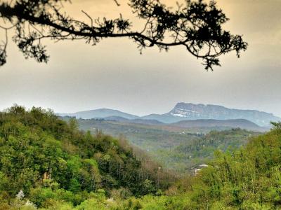
Places of the same kind
Lake — all places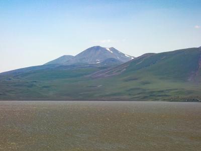
Nearby settlements