



Shaori Reservoir
Link copied
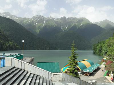
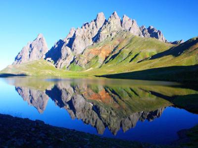
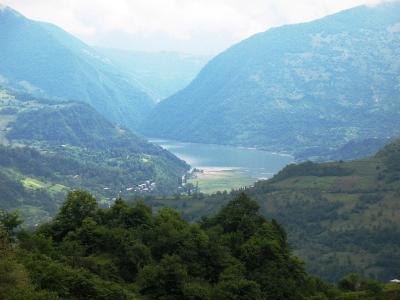
Photograph: Yasuhiro Kojima (CC BY-SA 2.0), G. N. (CC BY-SA 3.0), Stanko (CC BY-SA 4.0), Aleksey Muhranoff (CC BY-SA 3.0)
The largest reservoir of Racha-Lechkhumi, on the northern slope of the Racha range beyond the Nakerala pass at 1,100–1,200 metres: a lake 7.1 kilometres long and 9.2 square kilometres in area, created in the 1950s by an earth dam on the river Shaori, which covers two old lakes in a karst basin, feeds the Shaori hydroelectric plant with the highest head in Georgia and is a favourite of anglers and campers at the foot of Nikortsminda.
About
The Shaori reservoir, which people simply call Shaori lake, lies in the Shaori basin on the northern slope of the Racha range, exactly where the road that crosses the Nakerala pass from Kutaisi enters Racha. The lake stretches 7.1 kilometres from south-west to north-east, its greatest width is 2.7 kilometres, its area 9.2 square kilometres, its greatest depth 14.5 metres and its mean depth 9.8, and it holds 90.6 million cubic metres of water. It is fed by its tributaries and by the rain that falls directly on its surface, 1,500 millimetres a year. The basin is built of Lower Cretaceous limestone and the karst is strongly developed: before the reservoir there were two small karst lakes here, Kharistvali and Dzrikhistvali, which now lie under the water. The shores are mostly low and gently sloping, with bluffs in places; a broad-leaved forest surrounds the lake, and above it stands the village of Nikortsminda with its eleventh-century church.
The reservoir was created in the 1950s for the Shaori hydroelectric plant: a rockfill dam 11.5 metres high and 1,210 metres long holds back the river Shaori, which used to vanish periodically into karst sinkholes, and throws the water by a 3,750-metre canal, a 1,326-metre tunnel and a 2,895-metre pipeline into the Kvirila basin, into the Tkibuli valley, with a head of 478 metres, the highest in Georgia. The first unit started in 1955, and the plant has a capacity of 40 megawatts. So Shaori lies in Racha, but its electricity is born in Imereti.
Today Shaori is one of the busiest places of rest in Racha: tents go up on the shore, picnics are laid out, people swim in summer, anglers bring in carp and trout, mushrooms and berries are gathered in the forest, and a path climbs the Nakerala range above the lake. It is at its finest in autumn, when the forest around the lake turns red and the Nikortsminda ridge is mirrored in the water.
- Access notes
- The Kutaisi–Tkibuli–Ambrolauri road follows the shore after the Nakerala pass; Nikortsminda stands above the lake
- Parking available
- Yes
- Safety notes
- The water is cold even in summer, the bottom is muddy and there is no lifeguard; the dam area is off limits
History
The Shaori basin was always a place of water: two small lakes, Kharistvali and Dzrikhistvali, lay on its karst floor, and the river Shaori lost itself in sinkholes and ran underground; in the description of Prince Vakhushti this corner of Racha is wooded and full of lakes. The eleventh-century church of Nikortsminda was built above the basin partly because the road to the Nakerala pass and the lowlands could be watched from here.
In the middle of the twentieth century Soviet power engineering used the basin as a natural reservoir: for the upper step of the Shaori–Tkibuli cascade an earth dam was built in the 1950s and the water was sent by tunnel into the Kvirila basin with a head of 478 metres. The first unit of the Shaori plant was switched on in 1955, and the station remains the hydroelectric plant with the highest head in Georgia. The lake covered the old karst lakes and created a new landscape below the village of Nikortsminda.
Since 2007 the Shaori plant has belonged to the Czech company Energo-Pro. The reservoir is today part of the tourist routes of Racha, since every road from Kutaisi towards Nikortsminda and Ambrolauri passes along its shore.
Visit info
Shaori is about 60 kilometres from Kutaisi by way of Tkibuli and the Nakerala pass, and about 20 from Ambrolauri; the asphalt road follows the shore and several tracks lead down to the water. Marshrutkas to Ambrolauri run from the Kutaisi bus station. The lake is open, entry and camping are free, and no ticket or permit is needed; food and lodging are found in Ambrolauri and the nearby villages. Check the fishing rules locally. It is at its finest in autumn.
Safety
The water is cold even in summer, the bottom is muddy and drops away sharply in places, and there is no lifeguard: do not swim far from the shore and keep an eye on children. The dam and the intake are off limits. The Nakerala pass is icy and foggy in winter, and in a thunderstorm you should leave the water.
Tip
The best view comes on the descent from the Nakerala pass: stop at the first bend, where the whole lake and Nikortsminda fit in one frame; in the morning the water is windless and the ridge is mirrored in it. Autumn, the middle of October, is the most colourful. There is little shade on the shore, so take a hat and water, and carry your rubbish away. The Nikortsminda church, Barakoni and the Khvanchkara cellars of Ambrolauri fit into one day; on the Tkibuli side the Tkibuli reservoir lies on the way.
Sources
Nearby places
All places in the region
Places of the same kind
Lake — all places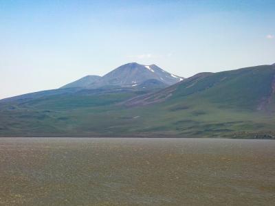
Nearby settlements